Wetlands are sites where water influences the soil and vegetation due to its presence for a sufficient amount of time (Couillard and Grondin 1992). Wetlands can therefore be permanently or temporarily flooded, but the soil and or dominant vegetation demonstrate the work of water. In Quebec, we classify wetlands into ponds, marshes, swamps and bogs.
|
Swamp |
|
|
|
Bog |
|
Long have wetlands been misjudged, thought as repulsive and even dangerous. Today, science shows that wetlands provide countless ecosystem services essential for our communities. Their most obvious function is to act like sponges. Indeed, because of their ecological components, they buffer flooding and water shortage periods. In the spring, they can hold water which reduces the intensity of floods and replenishes groundwater resources. During the summer, water is slowly released which decreases the severity of impacts caused by droughts. They are also a key transitional component between aquatic and terrestrial habitats and are therefore essential for many species, including threatened and vulnerable species. Wetlands are also known to filter water from runoff, lakes, streams and rivers, hold sediments, and prevent pollution dispersion. Wetland vegetation also holds the soil and slows water flow which reduces erosion levels, especially on river and stream banks. Wetlands may only seem like a house for mosquitoes, but they are actually essential for maintaining biodiversity, fulfilling a great deal of ecosystem services (for free, and effectively!), thus greatly enhancing our own quality of living.

Situation in Laval
According to the Conservation and enhancement of natural environments plan adopted in 2020 by the City of Laval, there would be about 1600 hectares of wetlands on Laval territory - be it in flood plains, agricultural zones or white zones. Most (74,4%) of Laval wetlands are classified as marshes and swamps. In 2004, we counted in white zones (zones with a potential for development) about 330 hectares of wetlands. In 2014, that number lowered to 288 hectares, and less than 60% of them were still intact, which shows clearly the great pressure endured by these fragile areas.
In 2017, the Law on the conservation of wetlands and water environments (Loi concernant la conservation des milieux humides et hydriques) was adopted, which brought hope that the last wetlands of Laval would be, at last, fully preserved. However, the destruction of 8 more hectares was allowed instead, between 2017 and 2019. CRE de Laval is therefore still fighting for the long-awaited adoption of a conservation plan at the regional level and hopes that the Regional wetlands and water environments plan (known as the PRMHH in French) that the City of Laval will submit in 2022 to the MELCC will allow us to reach, at last, the ambitious goal to protect all the wetlands of Laval that remain.
Image Gallery
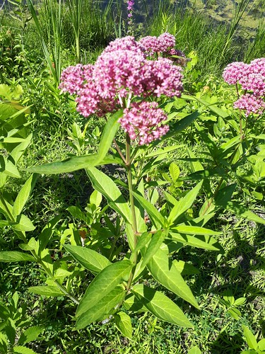
The following image gallery shows a number of plants typically found in local wetlands. These organisms are not necessarily endangered, some are actually quite abundant! This is also not a complete list of all wetland plants. Click on the photo below to see the gallery.
Completed project

Surveying of Laval’s wetlands
CRE de Laval started surveying wetlands in 2001. In 2016, an agreement was signed with the City of Laval to survey the entire territory. The contract was renewed with the City of Laval in 2019 and the project ended in 2021.
Publications (in French)
List of relevant reports
2014. État de la situation des milieux humides ciblés en zone blanche en 2014, 55 pages.
2012. Bilan de la situation des milieux humides de Laval, 12 pages.
2010. Bilan de la situation des milieux humides de Laval, 7 pages.
Disseminations
May 20, 2020 – Press release - 8,48 hectares de milieux humides ont disparu à Laval – La stratégie du ministère de l’Environnement et de la Lutte contre les changements climatiques ne fonctionne pas
December 12, 2016 –
March 10, 2016 –


